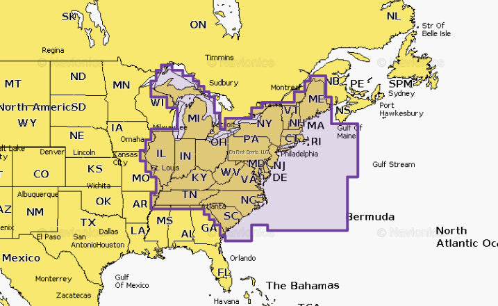
Navionics - U.S. East Map Card
Navionics - U.S. East Map Card
Ocean Township
3501 Sunset Avenue
Ocean Township NJ 07712
United States
- Nautical Chart – Comprehensive charts are derived from multiple officials, government, and private sources, displayed in a familiar look and feel
- SonarChart HD Bathymetry - Innovative 1' (0.5 m) bathymetry charts are created by using Navionics proprietary systems that augment existing content with sonar data contributed by the boating community
- Community Edits - Get useful local knowledge from edits made by users of the Navionics Boating app on your compatible smart device.
- Daily Updates - Up to 5,000 daily updates to our charts give you the most accurate, most current Navionics data available.1
- Dock-to-dock Route Guidance2 - Start your trip with a suggested path.
Navionics - U.S. East Map Card
5'8"
The Navionics Chart Installer software also ensures the freshest chart data every time out. Navionics dock-to-dock route guidance solutions give you a suggested path to follow through channels, inlets, marina entrances and more. Multiple shading options aid in shallow water navigation and make it easy to highlight a target depth range for the best fishing spots. Navionics Platinum+ charts include all the content of Navionics+ cartography, with integrated offshore and inland mapping, 42,000+ lakes and additional viewing options for relief shading, satellite imagery with SonarChart shading overlay, 3D perspective view, aerial photos, and more.
| SKU | UPC |
|---|---|
| 010-C1370-40 | 821245991775 |

